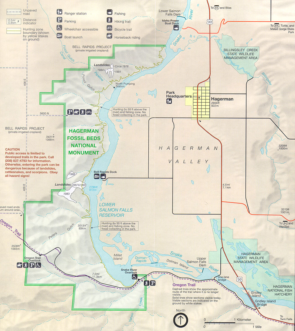
ocr: Unpaved station Fishing Lower Falls Salmon Dam To(84) and Bliss road Ranger 0.5mi 0.8km Distance indicator Parking Hiking trail Idaho Boat Power Dock 30 To(84), Tuttle, and Hunting zone Wheelchair accessible Bicycle trail Malad Gorge State Park boundary (shown by on yellow ground) stakes Boat launch Horseback riding BELL RAPIDS PROJECT (private irrigated cropland) BILLINGSLEY CREEK STATE WILDLIFE MANAGEMENT, AREA/ Landslides( Circa 1976 - 1984F n 71991 9 North Pumping Station Park Headquarters 63 2959ft Hagerman 922m Hunting (to 50ft above the 5600N PERE river) fossil and collecting fishing in ...